Accurate representations of urban expansion are of interest to a large scientific, socio- economic and policy-making community. The increasing aggregation of population and concomitant modification of land cover has both socio-economic and micro and meso-climatic, hydrologic, biophysical and ecologic impacts on the ambient environment. In order to quantify, monitor and model these impacts it is necessary to have accurate depictions of the spatial extent and physical properties of the urban area – however defined. Characterizing large-scale historical changes in urban spatial extent, however, remains a challenge due to the inherent complexity and variability of the urban environment. Even in data-rich countries there is little spatially explicit, land-cover specific, information on how much land is being converted for urban land use over time, how this expansion compares to increases in urban density and relates to a whole host of drivers and environmental changes. The problem is compounded by the lack of a single unambiguous definition of what distinguishes urban from non-urban. The broad diversity of urban forms compounds the problem of classification because the physical properties of urban environments are more diverse than most indigenous land cover classes.
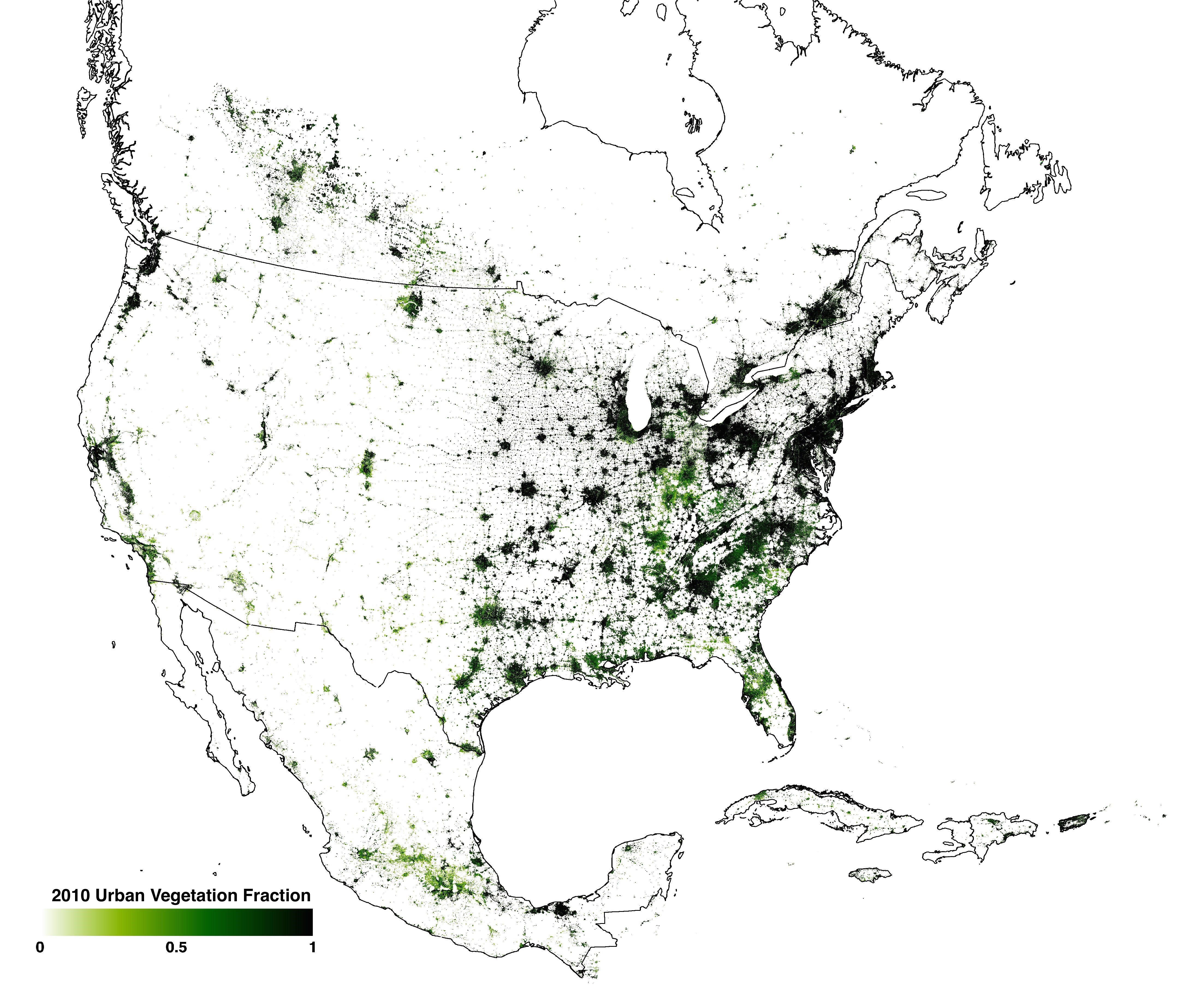
The goal of the proposed work is to develop a consistent, robust, scaleable, physically- based methodology for characterization of urban expansion using Landsat-style observations. We propose to use atmospherically corrected Landsat GLS time series in conjunction with DMSP/OLS nighttime lights, MODIS 500m land cover and high resolution imagery such as Ikonos, QuickBird and Worldview-2 to define a methodology for mapping time series of urban settlements and their built-up and vegetated components at 30m resolution through multi- temporal spectral mixture analysis (MTSMA). We will circumvent the persistent problem of inconsistent or arbitrary definitions of “urban” by categorizing distributions of measurable physical properties for different independent categorizations of urban extent (e.g. population density, brightness and temporal consistency of emitted light, spectral heterogeneity) as well as a representative sample of non-urban environments and then quantifying the variation in land cover properties for each independent spatial extent. The methodology will be tested and validated over North American settlements of a range of sizes and will be used to a) produce continental maps of physical properties for different categories of developed land cover for the nominal years 1990, 2000, 2005, and 2010 b) quantify the spatial extent of different land cover and their temporal changes for the period 1990 to 2010 and c) summarize how rates of urban expansion relate to changes in both physical properties and socio-economic metrics. The project will take advantage of the new NASA Earth Exchange collaborative with significant computing and storage resources. This proposal addresses the “detection” component of this NRA. It aligns with NASA’s research objective to “Quantify global land cover changes” and will contribute to answering 2003 U.S. Climate Change Science Program strategic plan question: “What observations and methods are needed to quantitatively characterize historic and current land- use and land-cover dynamics –that influence the sustainability of human societies and the environment ” by providing the first historic quantification of urban expansion and vegetation abundance changes from 1990 to 2010 for North America. This study will also address the third Objective of the MEGAPOLI project: “to develop and implement improved, integrated tools to assess the impacts of air pollution from megacities on regional and global air quality and climate and to evaluate the effectiveness of mitigation option”. The products developed as part of this study will be made publicly available through NASA’s Land cover Land Use Change program.

 Principal Investigator
 Postdoc Researcher