LCLUC science research projects at NASA often have practical applications which are suited to further development under the NASA Applied Sciences Program. The focus of the Appliied Sciences Program is to establish direct societal benefits from NASA research with operational data and information users. The program addresses applications of national priority emphasizing partnerships with agencies with an operational mandate e.g. USDA, USFS, FIMA, EPA, NPS, and international organizations e.g. UNFAO, UNDP and UNEP. Recently partnerships have been expanded to the private sector and non-governmental organizations. NASA applied sciences focus areas include aspects of agriculture, disasters, ecological forecasting, health and air quality, water resources, wildland fires. The approach is to enable the assimilation of remote sensing data and Earth Science model outputs to serve as inputs to decision support systems. Through a process of benchmarking, verification and validation the enhancement to the decision support system is documented and a pathway developed for the operational transition. Current LCLUC-related Applied Sciences projects include the use of remote in forest management, fire risk mapping, invasive species monitoring, flood inundation, crop yield forecasting and famine early warning.
NASA Near real-time data (LANCE)
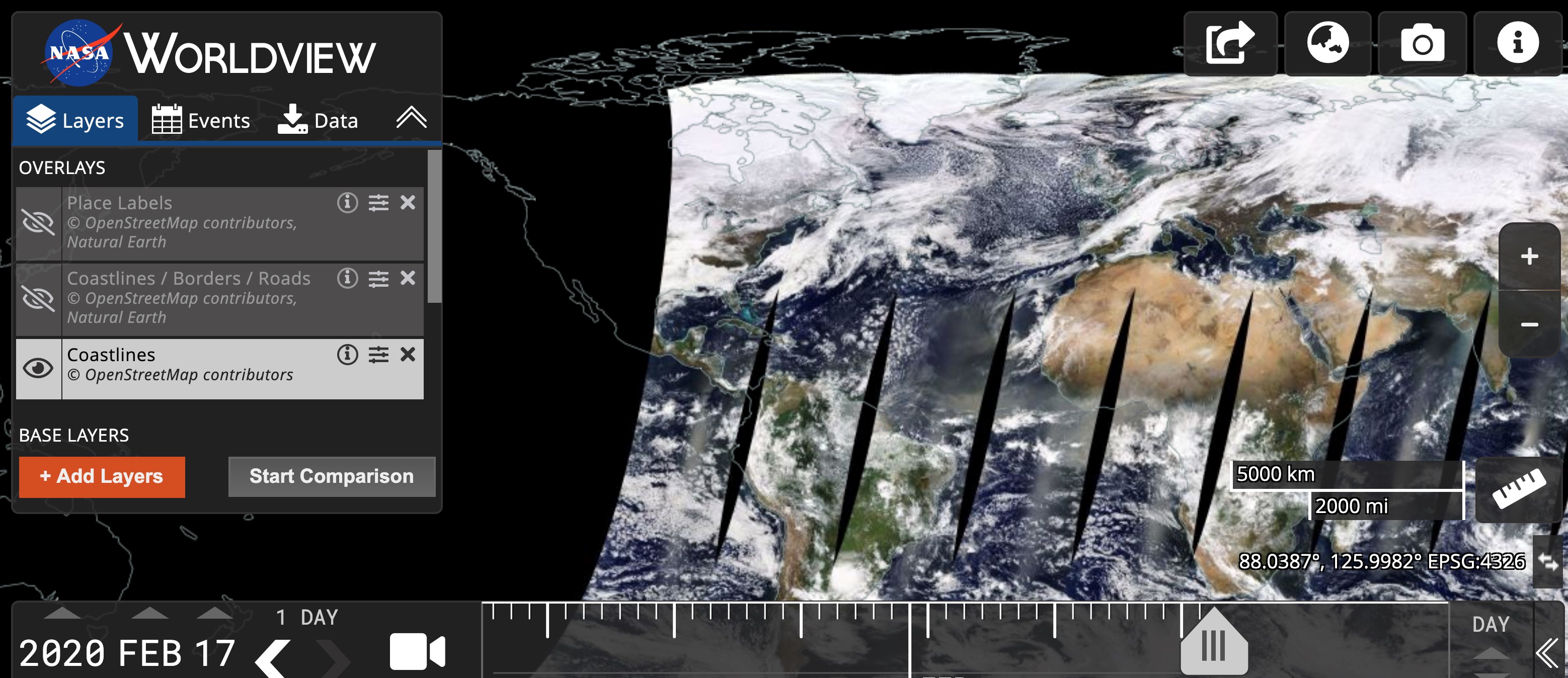
NASA's Land, Atmosphere Near real-time Capability for EOS (LANCE) makes Earth Observing System (EOS) data from ten NASA instruments available within three hours of satellite observation. This is to meet the timely needs of applications such as numerical weather and climate prediction; forecasting and monitoring natural hazards, ecological/ invasive species, agriculture, and air quality; providing help with disaster relief; and homeland security. LANCE users span a variety of communities interested in a range of applications. Users come from both the civilian and military sectors, from government and non-government agencies and from universities and other research institutions. Near real time data can be viewed using NASA’s Worldview capability.
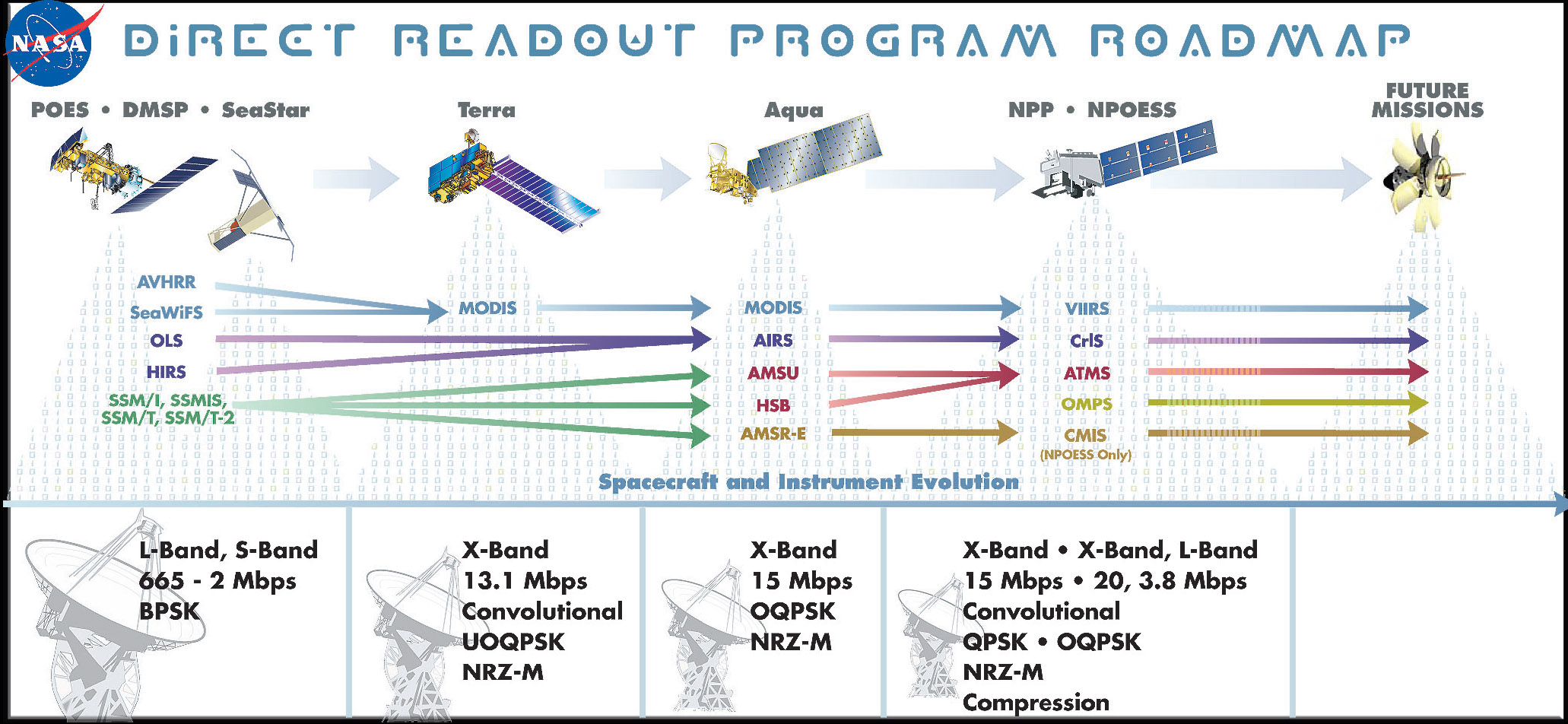
The NASA Direct Readout Program: Providing A Bridge Between NASA Direct Broadcast Earth Science Missions And The Direct Readout User Community
NASA's Direct Readout Laboratory (DRL) at Goddard Space Flight Center (GSFC) is the implementation arm of NASA's Direct Readout Program. The DRL acts as the bridge between Earth science remote sensing missions such as Terra, Aqua, and the NPOESS Preparatory Project (NPP), and the Direct Readout (DR) community. The DRL encourages communication and maintains an open-door policy with the commercial and research and development sectors. This process provides the DRL with critical information on DR systems currently in use, and the needs of the DR community.
Global Fire Information For Resource Management
NASA's Fire Information for Resource Management System (FIRMS) distributes Near Real-Time (NRT) active fire data within 3 hours of satellite observation from NASA's Moderate Resolution Imaging Spectroradiometer (MODIS) and NASA's Visible Infrared Imaging Radiometer Suite (VIIRS).Transitioning from a research to an operational system with an emphasis on Protected Areas The Fire Information for Resource Management System (FIRMS) aims to transition NASA funded research results and observations to operational partners to support decision making for management of Protected Areas (PAs) worldwide. Specifically, a Web GIS provides active fire, burned areas and NASA imagery to protected area managers around the World in easy to use formats for decision making. The information will be delivered through web based interactive maps and email and text message alerts. The operational partners in this project are the United Nations Food and Agriculture Organization (FAO), the United Nations Environment Program (UNEP) and Conservation International (CI).
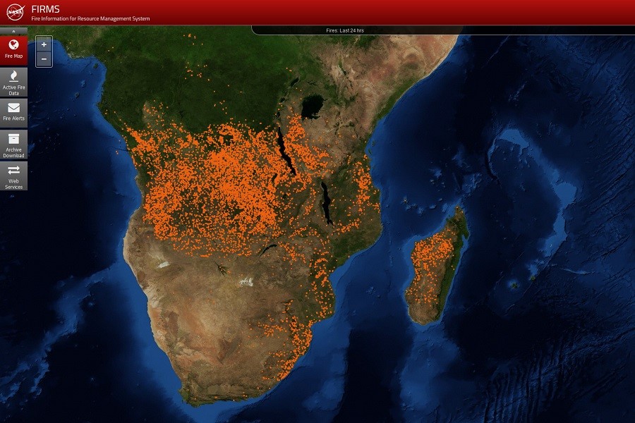
Each orange dot in this FIRMS Fire Map image of Africa and Madagascar from July 23, 2019, represents a hotspot detected over the past 24 hours by the Moderate Resolution Imaging Spectroradiometer (MODIS) instrument aboard NASA’s Terra and Aqua Earth observing satellites. Image courtesy of NASA FIRMS.
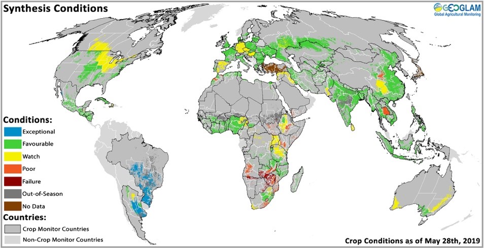
NASA Global Agricultural Monitoring
The NASA Applies Sciences Harvest Program builds on a significant investment in research and analysis. Algorithms developed by the MODIS instrument teams are used for monitoring crop phenology. Soil moisture products developed from satellite data are used to help monitor crop condition. Methods for agricultural land use classification are used for mapping crop type and area. Methods are being developed for crop yield estimation from field to national scales and research into monitoring agricultural land use change are included within the NASA LCLUC Program. The Harvest program is NASA’s contribution to the international GEO Global Agricultural Monitoring Program (GEOGLAM)
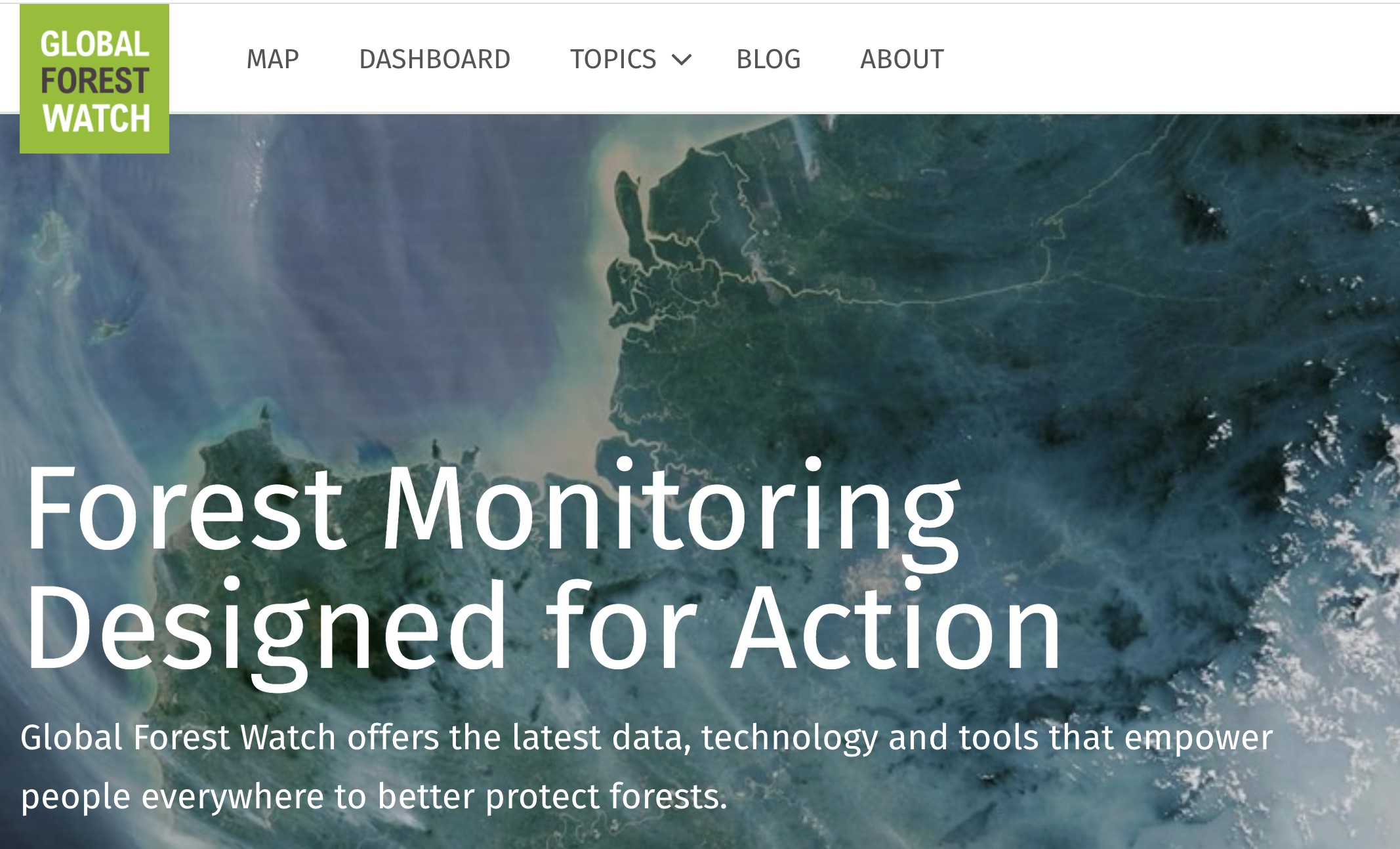
Global Forest Monitoring
NASA research and development on forest monitoring and change detection provides the basis for the Global Forest Watch. Global Forest Watch (GFW) which is run by the World Resources Institute, enables users to create custom maps, analyze forest trends, subscribe to alerts, or download data for their local area or the entire world. Users can also contribute to GFW by sharing data and stories from the ground via GFW’s crowdsourcing tools, blogs, and discussion groups. Special “apps” provide detailed information for companies that wish to reduce the risk of deforestation in their supply chains, users who want to monitor fires across Southeast Asia, and more. GFW serves a variety of users including governments, the private sector, NGOs, journalists, universities, and the general public.