Six Ways Satellites Tracked COVID-19
Three space agencies have released a database to help the public and policymakers trace the worldwide impact of the coronavirus. NASA, the European Space Agency (ESA), and the Japan Aerospace Exploration Agency (JAXA) have collaborated to provide an online portal with regularly updated metrics.
The satellite data “tell the story of what’s happening on the Earth right now,” said Thomas Zurbuchen, the associate administrator of NASA’s Science Mission Directorate.
At least 17 satellites are being actively used in the dashboard, and others will join in the future.

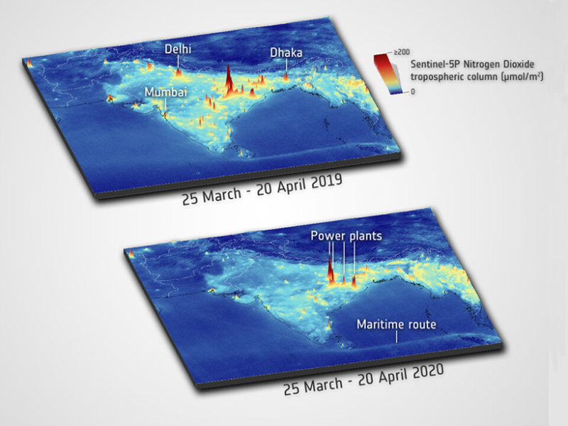
Nitrogen dioxide, a pollutant from burning fossil fuels, dropped in several major cities in India during lockdowns but continued at some power plants. The top map shows 2019 values, and the bottom one gives 2020 values. Credit: ESA